QGroundControl: The Complete Guide to Drone Ground Control and Mission Planning
If you’ve ever watched a drone fly a perfect grid pattern over a farm field or trace an exact survey route around a construction site, there’s a good chance QGroundControl was steering the show behind the scenes. It’s one of the most trusted names in open-source ground control software, and whether you’re a hobbyist flying your first Pixhawk-powered quad or an engineer managing a fleet of survey drones, this guide walks you through everything you need to know — from downloading and installing it, to planning missions, to fixing the connection headaches that trip up almost everyone at some point. Let’s get into it.
What Is QGroundControl?
QGroundControl (QGC) is a free, open-source ground control station (GCS) application used to configure, control, and plan missions for drones and other unmanned vehicles. It communicates with flight controllers using the MAVLink protocol, which is the same lightweight messaging language used by two of the most popular open-source autopilot systems: PX4 and ArduPilot.
In plain terms, QGroundControl is the software that sits on your laptop, tablet, or phone and talks to your drone. It shows you where your aircraft is, how fast it’s flying, how much battery it has left, and it lets you draw flight paths on a map before you ever leave the ground.
What makes QGC stand out is its balance. New pilots find the interface approachable, with a clean map view and drag-and-drop waypoints. Meanwhile, experienced developers and commercial operators get deep configuration access, including parameter tuning, firmware setup, and support for custom vehicles — beyond just multirotors, planes, rovers, boats, and submarines are all fair game.
It’s developed under the Dronecode Foundation umbrella and maintained largely by contributors from the PX4 community, though it works equally well with ArduPilot-based systems.
QGroundControl Features and Capabilities
QGroundControl isn’t just a single-purpose app — it’s closer to a full cockpit for unmanned systems. Here’s a breakdown of what it actually does.
Ground Control Station
At its core, QGC functions as a real-time monitoring dashboard. Once connected, it displays:
- Live GPS position on a satellite or street map
- Altitude, airspeed, and ground speed
- Battery voltage and remaining flight time estimates
- Heading, attitude, and a customizable Heads-Up Display (HUD)
- Signal strength and telemetry link quality
This “ground station” role is what most people picture first — a screen full of live flight data — but it’s really just one layer of what the software offers.
Drone Control and Flight Planning
Beyond monitoring, QGC lets you actually plan and execute flights. You can:
- Build multi-waypoint missions by clicking directly on the map
- Set altitude, speed, and camera actions per waypoint
- Design automated survey patterns for mapping and photogrammetry
- Set geofences and safety boundaries
- Trigger manual override at any point during an autonomous flight
This combination of live control and pre-planned automation is what makes QGroundControl popular for both recreational flying and commercial applications like agricultural mapping, infrastructure inspection, and search-and-rescue support.
Telemetry and MAVLink Support
Telemetry is really the backbone of the whole system. QGC supports multiple connection types, including:
- USB (direct wired connection)
- Radio telemetry modules (like SiK radios)
- Wi-Fi and network-based connections
- TCP/UDP links for simulation and companion computers
Since it speaks native MAVLink, QGC can connect to virtually any vehicle running PX4 or ArduPilot firmware without needing a proprietary bridge or adapter — a major advantage over closed-source, brand-locked apps.
QGroundControl Download
Before you can plan a single mission, you need to get the software installed. QGroundControl is completely free and runs across nearly every major platform.
Download for Windows
QGC is fully supported on Windows and remains one of the most common platforms for drone operators, especially in commercial and enterprise settings.
QGroundControl for Windows 11 runs natively with no compatibility layer needed, and the installer includes shortcuts for standard mode plus GPU compatibility and GPU safe modes — handy if you run into graphics driver issues.
QGroundControl for Windows 10 is also fully supported, provided you’re on version 1809 or later. If your Windows 10 build is older than that, you’ll want to update Windows first before installing.
Download for Android
Flying with a tablet or phone is popular among hobbyists and field operators who want a lighter setup. QGC’s Android build supports full flight control and mission planning, and it works with both PX4 and ArduPilot vehicles. It’s a genuinely capable version, not a stripped-down companion app.
Download for Ubuntu
Linux users, particularly those working in robotics or research environments, often prefer Ubuntu. The official AppImage builds are designed for Ubuntu 24.04 LTS and newer. If you’re still on Ubuntu 22.04, you can get it running, but you’ll need to build it from source yourself since there’s no pre-packaged installer for that version.
Heads up: Ubuntu ships with a built-in modem manager that can interfere with serial and USB connections to flight controllers. Remove or disable it before connecting your drone over USB or a telemetry radio.
QGroundControl Latest Version
Here’s a quick snapshot of where the software stands:
| Detail | Information |
|---|---|
| Latest stable release | v5.0.8 |
| Upcoming release | v5.1 (in release candidate stage) |
| License | Apache License 2.0 / GPLv3 |
| Supported firmware | PX4 and ArduPilot |
| Platforms | Windows, macOS, Linux (Ubuntu), Android, iOS |
| Developer | QGroundControl Team / Dronecode community |
Because it’s under active, community-driven development, checking the official QGroundControl documentation before a big install is always a smart habit — release notes and compatibility details change more often than most users expect.
How to Install QGroundControl
Downloading is only step one. Installation varies slightly depending on your operating system, so here’s what to expect on each.
Installer and Setup
Across all platforms, the general flow is the same: download the correct build for your OS, run the installer or mount the package, and grant the necessary permissions for USB or network access.
Installation on Windows
- Download the .exe installer from the official site.
- Double-click the file to launch the installer wizard.
- Follow the prompts — no special configuration is usually needed.
- Once complete, you’ll find three shortcuts: standard QGroundControl, GPU Compatibility Mode, and GPU Safe Mode.
If your drone doesn’t show up after installation, it’s often a driver issue rather than a QGC problem — more on that in the troubleshooting section below.
Installation on Android
- Download the APK from the official source or Google Play Store.
- Allow installation from your chosen source if prompted.
- Open the app and grant location and USB/storage permissions when asked.
- Connect your flight controller via USB-OTG cable, or pair a telemetry radio over Bluetooth/Wi-Fi.
Installation on Ubuntu
- Download the AppImage file for Ubuntu 24.04 LTS or later.
- Make the file executable using a terminal command (chmod +x).
- Remove the default modem manager to avoid serial port conflicts.
- Install GStreamer dependencies if you plan to use video streaming.
- Run the AppImage directly — no traditional installation process is required.
System Requirements
| Component | Recommended Specification |
|---|---|
| RAM | 8 GB or more |
| Storage | SSD preferred |
| Graphics | Dedicated Nvidia or AMD GPU |
| Processor | Intel i5 or equivalent |
| OS | Latest version of Windows, macOS, or Ubuntu for best compatibility |
The app will technically run on lighter hardware, but performance — especially map rendering and video streaming — improves noticeably on more capable machines.
How to Use QGroundControl
Once installed, the learning curve is fairly gentle if you take it step by step.
User Guide
The official documentation is genuinely one of the better resources in the drone software space, covering everything from initial setup to advanced parameter tuning. It’s worth bookmarking even if you consider yourself experienced.
Tutorial for Beginners
If this is your first time opening QGC, here’s a simple starting sequence:
- Connect your flight controller via USB first, before opening the app, so it’s auto-detected.
- Launch QGroundControl — it should recognize the vehicle and pull up its telemetry automatically.
- Head to the Vehicle Setup section to run through sensor calibration (compass, accelerometer, radio).
- Check your firmware version and update it if prompted.
- Once calibrated, switch to the Fly View to see live telemetry, or the Plan View to start building missions.
Taking the calibration step seriously matters more than people expect — a poorly calibrated compass is one of the most common reasons drones drift or fly erratically during their first flights.
QGroundControl Mission Planner
This is where QGroundControl really shines for anyone doing more than casual flying.
Mission Planning
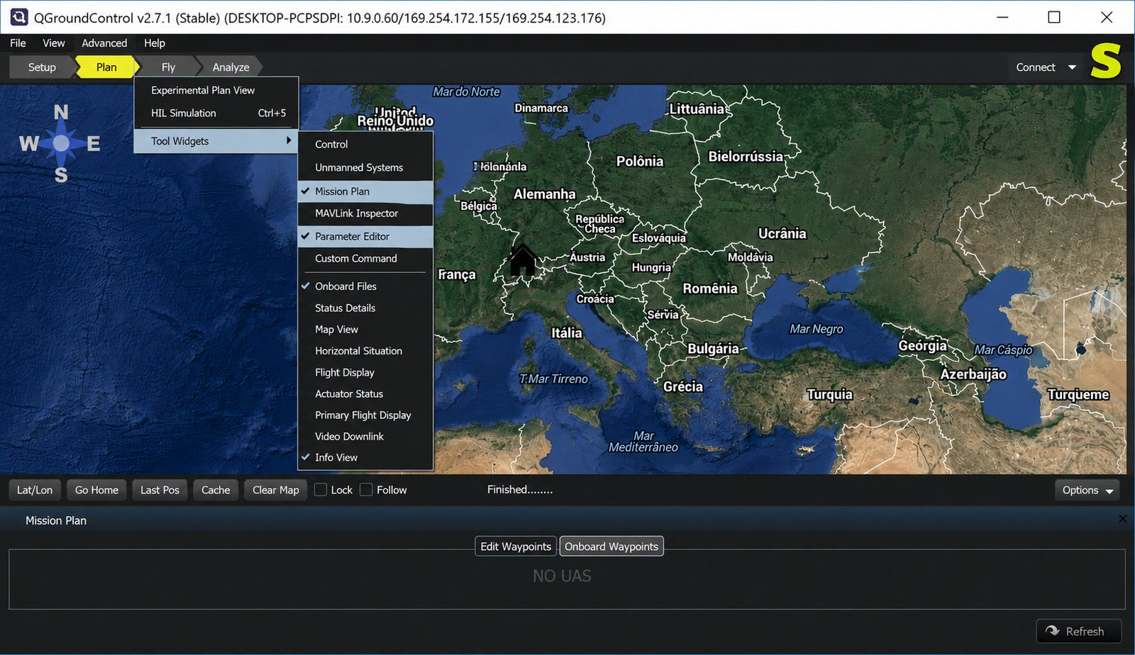
Mission planning in QGC revolves around the Plan View, a map-based interface where you build out the exact path your drone will fly autonomously. You’re not just setting a destination — you’re scripting a full sequence of actions.
Waypoint Planning
Adding waypoints is intuitive:
- Click anywhere on the map to drop a waypoint
- Drag existing waypoints to adjust the route
- Set individual altitude and speed per point
- Attach actions like “take photo” or “start video” to specific waypoints
- Reorder or delete points as needed before uploading the mission
Survey Mission Planning
For mapping and photogrammetry work, QGC includes a dedicated Survey tool. You draw a polygon over the area you want covered, and the software automatically generates a grid flight pattern based on your camera specs, desired overlap percentage, and target ground resolution.
This is genuinely one of the most useful features for anyone doing agricultural mapping, land surveying, or construction progress monitoring — it removes the guesswork of manually plotting dozens of parallel lines.
Flight Planning
Beyond simple waypoints and surveys, you can combine multiple mission types, set geofences to keep the aircraft within a legal or safe boundary, and configure rally points as safe return locations in case of signal loss.
Configure Autonomous Flights
Once your mission is built, you upload it to the vehicle, arm the drone, and switch to Auto or Mission mode. From there, QGC monitors execution in real time, and you retain the ability to pause, resume, or take manual control at any moment — an important safety net for beginners and professionals alike.
Monitor Drone Missions and Telemetry
During flight, the Fly View becomes your primary dashboard, streaming live position, altitude, and system health data. Any warnings — low battery, GPS degradation, lost telemetry link — appear immediately so you can react before it becomes a problem.
Video Streaming
If your drone carries a camera with a compatible video feed, QGC can display it live within the app, often with an overlay of key flight instruments. On Linux, this requires GStreamer to be properly installed, which is why it’s worth setting up during initial installation rather than scrambling for it mid-flight.
QGroundControl and Flight Controllers
One of QGroundControl’s biggest strengths is firmware flexibility — it doesn’t lock you into a single autopilot ecosystem.
QGroundControl with PX4
QGC was essentially built alongside PX4 and remains its primary companion ground station. If you’re running PX4 firmware, you’ll get the most complete feature set, including full parameter access and the smoothest firmware update process.
QGroundControl with ArduPilot
ArduPilot support is also strong, though historically Mission Planner has been the more common companion app for ArduPilot users (more on that comparison shortly). Still, QGC supports ArduCopter, ArduPlane, ArduRover, and ArduSub, making it a genuinely cross-compatible option.
QGroundControl with Pixhawk
Pixhawk is a hardware standard, not a firmware, and it can run either PX4 or ArduPilot. QGC works with virtually any Pixhawk-based flight controller, which is part of why it’s so widely recommended in beginner tutorials and open-source drone-building communities.
Flight Controller Setup
Basic setup typically involves:
- Flashing the correct firmware (PX4 or ArduPilot) onto your flight controller
- Running the built-in sensor calibration wizard
- Configuring your radio control transmitter and mapping flight modes
- Setting failsafe behaviors for lost signal or low battery
MAVLink Configuration
For most users, MAVLink connections work automatically once your telemetry radio or USB cable is plugged in. Advanced users managing multiple vehicles or custom companion computers may need to manually configure MAVLink endpoints, baud rates, or network ports — all adjustable from the Comm Links section in settings.
Telemetry Setup
If you’re using radio telemetry rather than direct USB, both the air and ground radio modules need matching baud rates and frequency settings. Mismatched configurations are a frequent source of “no telemetry” errors, so double-checking both ends is worth the extra minute.
QGroundControl vs Mission Planner
This comparison comes up constantly in drone forums, and for good reason — these are the two dominant free, open-source ground control options.
| Feature | QGroundControl | Mission Planner |
|---|---|---|
| Platform support | Windows, macOS, Linux, Android, iOS | Primarily Windows (Linux via emulation) |
| Firmware support | PX4 and ArduPilot | Primarily ArduPilot |
| Interface style | Modern, streamlined, beginner-friendly | Feature-dense, more technical |
| Best for | Cross-platform flexibility, PX4 users | Deep ArduPilot tuning, log analysis |
| Community favorite in | PX4 ecosystem | ArduPilot ecosystem |
| Advanced scripting | Limited | Extensive |
Choose QGroundControl if
- You want one app that works across desktop and mobile
- You fly PX4 firmware, or switch between PX4 and ArduPilot
- You want a cleaner, more beginner-friendly interface
Choose Mission Planner if
- You’re deep into ArduPilot-specific tuning
- You need detailed dataflash log analysis
- You want extensive scripting on Windows specifically
Many experienced operators actually keep both installed — using QGC for day-to-day flying and mission planning, and Mission Planner for deep diagnostic work when something needs closer inspection.
If you’re managing drone footage and photos alongside your mission planning workflow, it’s also worth exploring related tools — our guide on 4K Stogram covers how to organize and download media efficiently, which pairs well with any drone content pipeline.
QGroundControl Documentation and Resources
User Guide and Support
The official user guide is comprehensive and regularly updated, covering everything from first-time setup to advanced vehicle configuration. It’s the first place to check before posting a support question in forums.
GitHub Repository
Since QGC is fully open source, its source code lives publicly on GitHub under the mavlink/qgroundcontrol repository. This is also where release notes, bug reports, and feature discussions happen in the open.
Build and Development
Developers wanting to customize the app or contribute code can clone the repository and build it locally. This is common among companies building white-labeled or customized ground control solutions on top of the open-source base.
Source Code
Because the source is publicly available under Apache 2.0 and GPLv3 licensing, businesses and researchers can legally modify and redistribute it, which is part of why it’s become a foundation for so many specialized drone applications.
QGroundControl Troubleshooting
Almost every pilot runs into at least one of these issues eventually. Here’s how to work through the most common ones.
Not Connecting to Drone
- Confirm the USB cable actually supports data transfer, not just charging
- Check that no other application (like Mission Planner) is holding the connection
- Restart both the drone and the ground station app
- Try a different USB port, ideally directly on the motherboard rather than a hub
MAVLink Connection Problems
- Verify the correct baud rate is selected under Comm Links
- Make sure only one MAVLink connection is active at a time
- Check firewall settings if using a network-based (UDP/TCP) connection
Telemetry Issues
- Confirm both telemetry radios are on matching frequencies and baud rates
- Check for physical obstructions or interference from other 2.4GHz devices
- Test the radio pair at close range first before assuming a hardware fault
PX4 Connection Problems
- Ensure the firmware version is compatible with your installed QGC version
- Reflash firmware if the vehicle isn’t responding to calibration commands
- Check for a proper GPS lock before expecting full telemetry data
Pixhawk Connection Issues
- Confirm the correct Pixhawk variant is selected during firmware flashing
- Inspect USB cable and port for physical damage
- Reset to default parameters if the board behaves unpredictably after a failed update
Installation Problems on Windows
Common fixes: Run the installer as administrator if permissions errors appear, try GPU Compatibility or GPU Safe Mode if the map view fails to render, and temporarily disable antivirus software that may be blocking the installer.
Frequently Asked Questions About QGroundControl
Yes, QGroundControl is completely free and open source, licensed under Apache 2.0 and GPLv3, with no paid tiers or locked features.
It’s used to configure flight controllers, monitor live telemetry, and plan autonomous missions for drones and other unmanned vehicles.
Yes, it supports both, though Windows 10 requires build 1809 or later for full compatibility.
Yes, PX4 is QGroundControl’s primary supported firmware, and the two are developed closely together.
Yes, it fully supports ArduCopter, ArduPlane, ArduRover, and ArduSub firmware builds.
Absolutely — QGroundControl works with virtually any Pixhawk-based flight controller running either PX4 or ArduPilot.
Yes, there’s a fully functional Android version that supports mission planning and flight control, not just monitoring.
Final Verdict
QGroundControl has earned its reputation for a simple reason: it works, and it keeps working across whatever setup you throw at it. Whether you’re calibrating your very first Pixhawk build or planning a precision agricultural survey across dozens of acres, the software scales with your skill level instead of boxing you in.
If you’re just starting out, don’t worry about mastering every feature on day one. Install it, connect your drone, run through calibration, and fly a simple waypoint mission first. The rest — surveys, geofencing, advanced telemetry — will make a lot more sense once you’ve seen the basics work in the real world.
One Response