Metes and Bounds Software: Land Survey, Deed Plotting & Property Boundary Mapping
If you’ve ever stared at a property deed full of phrases like “thence North 45 degrees East 200 feet” and had no idea what it actually meant on the ground, you’re not alone. That confusing string of directions and distances is called a metes and bounds description, and it’s one of the oldest ways of defining land ownership in the United States.
The good news: you don’t need a surveying degree to make sense of it anymore. Metes and bounds software can take that same legal language and turn it into an actual map — showing you the shape, size, and boundaries of a piece of land in seconds. This guide walks through what metes and bounds actually means, how the survey system works, and how modern deed-plotting software helps landmen, realtors, title companies, genealogists, and property owners turn a wall of legal text into a usable property map.
What Is Metes and Bounds?
Metes and Bounds Definition and Meaning
Metes and bounds is a system used to describe the boundaries of a piece of land using physical features, directions, and distances rather than a simple grid reference. The word “metes” refers to measurements — distances and directions between points — while “bounds” refers to boundaries, which can be natural (a river, a large rock, a tree line) or man-made (a fence, a road, a survey marker).
Put simply, a metes and bounds description is a step-by-step set of walking directions around the edge of a property, starting and ending at the same point.
What Does Metes and Bounds Mean in Land Surveying?
In surveying terms, metes and bounds is one of the three major land description systems used in the U.S., alongside the rectangular (Public Land Survey) system and lot-and-block platting. It’s the oldest of the three, tracing back to colonial-era England, where land was described relative to landmarks rather than a standardized grid.
What Are Metes and Bounds in a Legal Property Description?
A legal property description written in metes and bounds format typically starts at a point of beginning (POB), then lists a series of “calls” — each one a bearing (compass direction) and a distance — until the boundary line returns to the POB, closing the shape.
A short example might read:
Beginning at an iron pin on the east side of Route 9; thence North 10° East 300 feet to a stake; thence South 80° East 250 feet to an oak tree; thence South 10° West 300 feet to a fence post; thence North 80° West 250 feet to the point of beginning.
Common Misspellings: Meets, Mete, Mets and Meats and Bounds
Because the term sounds unfamiliar, it’s often typed incorrectly. People frequently search for “meets and bounds,” “mete and bounds,” “mets and bounds,” or even “meats and bounds” — all of which refer to the same metes and bounds system described above.
How the Metes and Bounds Survey System Works
Understanding Metes: Distances and Measurements
Each “mete” in a legal description is a straight-line measurement, typically given in feet, chains, rods, or varas (a unit still common in older Texas and Southwestern deeds). Older deeds may also reference links and poles, historical units that modern software can automatically convert to feet or meters.
Understanding Bounds: Property Lines and Physical Boundaries
The “bounds” are the reference points that anchor each mete — a boulder, a creek bed, a neighboring fence, or a surveyor’s monument. In modern deeds, these bounds are more often permanent survey markers (rebar, concrete monuments) rather than natural features, since natural landmarks can shift or disappear over time.
How Bearings and Distances Define Property Boundary Lines
A bearing describes direction using compass degrees measured from north or south — for example, “North 45° East” means 45 degrees east of due north. Combined with a distance, each bearing-and-distance pair (a “call”) plots one straight segment of the property line. String enough calls together and you get a closed polygon representing the parcel.
How to Read a Metes and Bounds Legal Description
Reading one of these descriptions is mostly about breaking it into calls:
- Find the point of beginning.
- Identify each bearing (direction) and distance (length) in order.
- Note any curves, which are described with a radius and arc length instead of a straight bearing.
- Confirm the final call returns to the point of beginning — this is called closure.
Metes and Bounds Survey Method Explained
How Surveyors Use Metes and Bounds to Map Land
Licensed surveyors walk (or now, GPS-scan) a property’s boundary, recording bearings and distances at each turn. That raw field data becomes the legal description recorded in county land records, which is later used by title companies, buyers, and mapping software to reconstruct the parcel’s shape.
Turning Bearings and Distances into Coordinates
To draw a metes and bounds description on a map, each bearing and distance is converted into X/Y (or latitude/longitude) coordinates using basic trigonometry — essentially treating the point of beginning as the origin, then calculating each new point based on the direction and length of the previous call.
Calculating Property Boundary Lines from Survey Data
Once every call has been converted into a coordinate, connecting the dots in order produces the boundary lines of the parcel. This is exactly what deed-plotting software automates — instead of manually running trigonometric calculations for dozens of calls, the software does it instantly.
How to Calculate Land Area from a Legal Description
Once the coordinates form a closed shape, land area is typically calculated using the shoelace formula (also called the surveyor’s formula), which multiplies and sums coordinate pairs to find the enclosed area — then converts that to acres or square feet.
Metes and Bounds Examples
Simple Metes and Bounds Example
A basic rectangular lot might read: “Beginning at the northeast corner of Lot 4; thence South 100 feet; thence West 150 feet; thence North 100 feet; thence East 150 feet to the point of beginning.” That’s a simple four-sided parcel.
Metes and Bounds Drawing and Property Map Example
When plotted, that same description becomes a rectangle roughly 100 feet by 150 feet on a map, with each corner marked and labeled by its bearing and distance from the previous point.
How to Plot Metes and Bounds on a Map
To plot it manually, you’d draw the first line at the given bearing and length, then rotate your protractor for the next bearing, and repeat until the shape closes. Software replaces that manual protractor-and-ruler process with automatic, precise plotting.
Metes and Bounds Example for AP Human Geography
Textbooks often use an irregular, curving parcel — following a river on one side and straight survey lines on the others — to illustrate how metes and bounds boundaries differ from the perfectly square parcels found in the rectangular survey system.
Metes and Bounds in AP Human Geography
Metes and Bounds AP Human Geography Definition
In AP Human Geography, metes and bounds is taught as one of the historical land survey systems, typically discussed alongside the Public Land Survey System (Township and Range) and long lot systems used in settlement geography.
Metes and Bounds APHG Survey System Explained
The course frames metes and bounds as the system used in the original thirteen colonies and other early-settled areas, where land was surveyed and divided based on existing natural and man-made features rather than a uniform grid.
Is Metes and Bounds a Clustered or Dispersed Land Survey System?
Metes and bounds tends to produce irregular, unevenly shaped parcels, which historically supported more clustered, unplanned settlement patterns — unlike the grid-based township and range system, which produced dispersed, evenly spaced farmsteads.
Metes and Bounds AP Human Geography Practice Example
A typical practice question might show a map with oddly shaped, non-rectangular parcels following a river, and ask students to identify which land survey system produced that pattern. The correct answer is metes and bounds, precisely because of its irregular, feature-based boundaries.
Metes and Bounds vs Township and Range
Key Differences Between Metes and Bounds and Township and Range
| Feature | Metes and Bounds | Township and Range |
|---|---|---|
| Basis | Natural/man-made landmarks, bearings and distances | Uniform grid of townships and sections |
| Shape of parcels | Irregular | Regular, mostly square |
| Common region | Original 13 colonies, Texas, parts of the Northeast | Midwest, West, most of the U.S. outside original colonies |
| Ease of description | Requires detailed legal description | Simple section/township/range reference |
| Historical origin | English common law tradition | Land Ordinance of 1785 |
Township and Range vs Metes and Bounds Survey Systems
Township and range divides land into a predictable grid of 36-square-mile townships, each split into one-square-mile sections — making legal descriptions much shorter and more standardized than metes and bounds. Metes and bounds, by contrast, can require paragraphs of bearings and distances to describe a single irregular parcel.
Which Land Survey System Is Used for Property Descriptions?
Both systems are still in active use today, depending on the state and how a region was originally surveyed. Many deeds even combine the two, referencing a township-and-range section as a starting reference point, then switching to metes and bounds for the specific parcel boundary within it.
What Is Metes and Bounds Software?
Metes and Bounds Mapping Software Explained
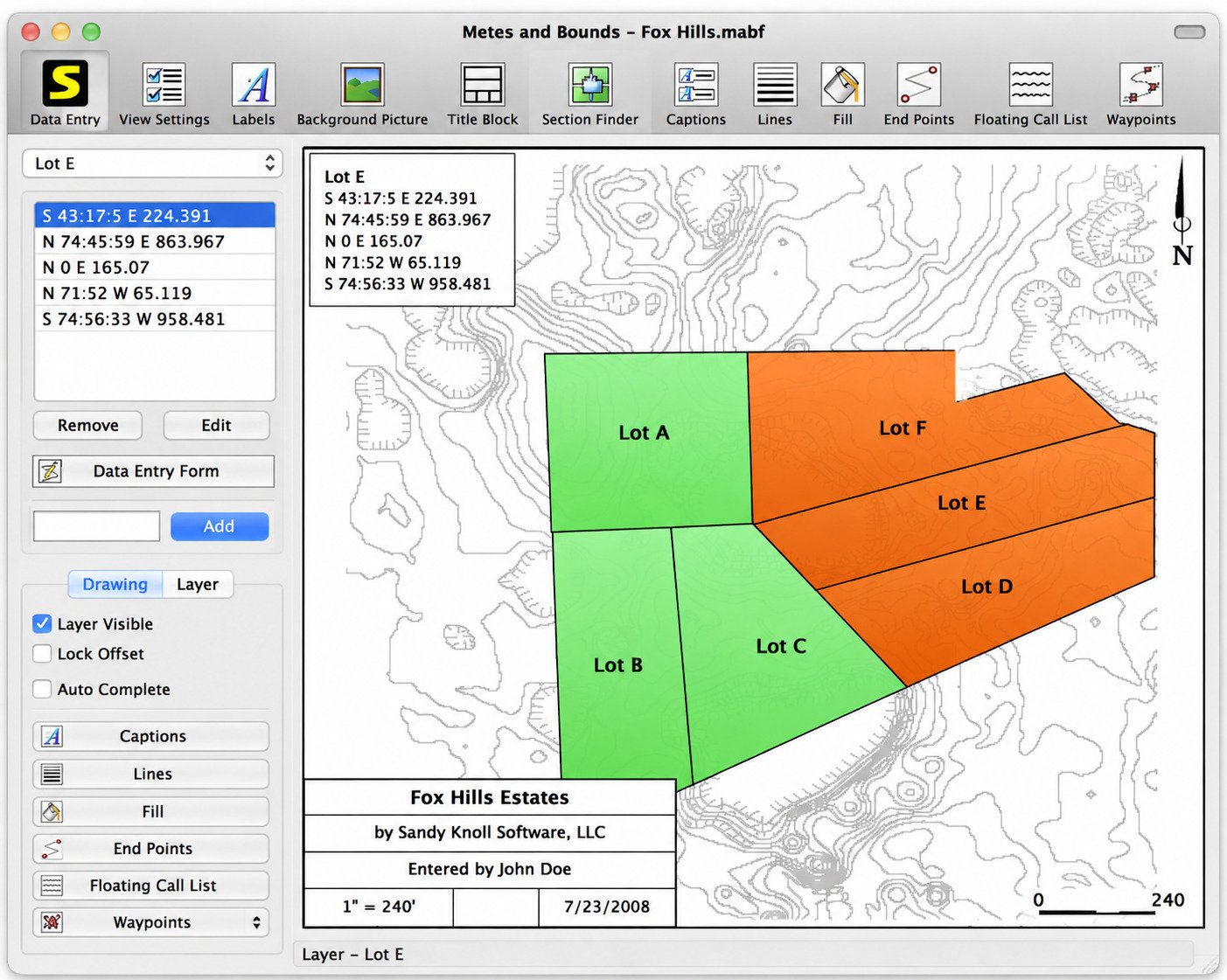
Metes and bounds software takes the bearings-and-distances text from a legal description and automatically converts it into a scaled, plotted map — handling the coordinate math, unit conversions, and closure checks that would otherwise be done by hand. Established tools like Sandy Knoll Software’s Metes and Bounds Plotter have offered this kind of deed-plotting functionality for years.
Metes and Bounds Land Survey Software for Property Mapping
This kind of software isn’t a replacement for a licensed survey, but it’s widely used as a quick visualization tool — helping people see roughly what a parcel looks like, check acreage, and spot potential description errors before involving a professional surveyor.
Metes and Bounds Deed Plotting and Legal Description Software
Deed plotting software specifically focuses on taking the legal description straight from a recorded deed and rendering it visually, often layering the result onto satellite or road maps for context.
Who Can Use Metes and Bounds Property Mapping Software?
- Landmen and title researchers verifying mineral or surface ownership
- Real estate agents showing buyers the approximate shape of a lot
- Genealogists mapping ancestral land grants from old deeds
- Surveyors and engineers doing preliminary checks before fieldwork
- Homeowners curious about their own property boundaries
Metes and Bounds Software Features
Plot Legal Descriptions from Deeds
Most tools let you type or paste a legal description directly and generate a plat drawing automatically.
Convert Bearings and Distances to Property Coordinates
Software handles the trigonometry behind the scenes, converting each call into a coordinate pair without manual calculation.
Create Property Boundary and Parcel Maps
Once plotted, the boundary can be exported as an image, PDF, or CAD file, or overlaid onto a satellite map for real-world context.
Calculate Land Area, Acreage and Parcel Measurements
Area, perimeter, and closure error are usually calculated automatically — closure error being how far off the final point is from the starting point, which flags potential mistakes in the description.
Use a Metes and Bounds Calculator and Coordinate Plotter
Many programs include a standalone calculator mode for quickly checking a single bearing-and-distance call without building a full map.
Export and Manage Land Survey Mapping Data
Common export formats include KML and GPX (for GPS devices and Google Earth), CSV (for spreadsheets), and DXF (for CAD programs).
Metes and Bounds Download and Installation
Metes and Bounds Software Download for PC
Desktop deed-plotting programs are typically downloaded directly from the developer’s website, with separate installers for Windows and Mac.
Metes and Bounds Software for Windows
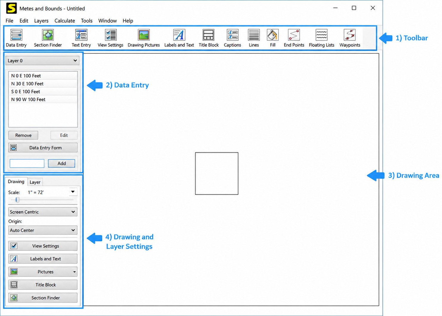
Windows remains the most widely supported platform for this category of software, since many surveying and title-industry tools were originally built for it.
Metes and Bounds Latest Version
Because legal description formats and mapping standards evolve slowly, updates to this type of software tend to focus on usability, export formats, and mapping integrations rather than major overhauls — so it’s worth checking the developer’s site for the current version before downloading.
Metes and Bounds Free Download Options
Several developers offer free or trial versions with basic plotting features, reserving advanced tools (like GPS export or multi-tract projects) for paid tiers.
How to Install Metes and Bounds Software
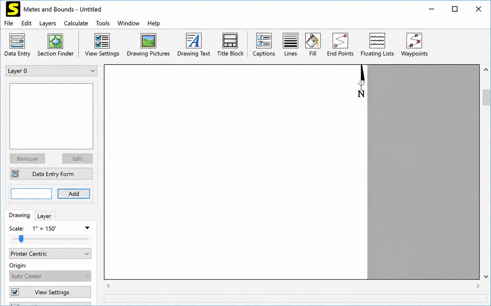
- Download the installer from the official developer site.
- Run the installer and follow the on-screen prompts.
- Launch the program and check for available updates.
- Import or type in your first legal description to test the plotting function.
How to Use Metes and Bounds Software
Metes and Bounds Software Tutorial for Beginners
Most programs follow the same basic workflow: enter the description, let the software calculate coordinates, review the plotted shape, then export or print the result.
How to Enter a Property Legal Description
You’ll usually type or paste each call in order — bearing, distance, and unit — starting from the point of beginning, exactly as it’s written in the deed.
How to Plot a Property Deed
Once every call is entered, the software connects them in sequence, automatically closing the polygon if the description returns to its starting point.
How to Map a Parcel from a Legal Description
For multi-tract deeds, most tools let you plot each tract separately, then position them relative to each other on the same map.
How to Create a Property Boundary Map
After plotting, you can typically add labels, a scale bar, a title block, and a north arrow before exporting a finished boundary map.
How to Plot Land Survey Coordinates
If you already have coordinate data (rather than bearings and distances), many tools also support direct coordinate entry or CSV import.
Metes and Bounds Calculator Tools
Metes and Bounds Coordinate Calculator
Converts a single bearing and distance into an X/Y coordinate relative to a starting point — useful for spot-checking one call in a longer description.
Metes and Bounds Bearing Calculator
Helps convert between bearing formats (quadrant bearings like “N45°E” versus azimuth degrees like “045°”), which older and newer deeds sometimes mix.
Metes and Bounds Distance Calculator
Converts distances between units — feet, chains, rods, links, and varas — a common need when working with historical deeds.
Metes and Bounds Area and Acreage Calculator
Applies the surveyor’s (shoelace) formula to a set of plotted points to calculate total enclosed area in square feet or acres.
Survey Bearing and Distance Calculator
A general-purpose tool for converting between bearing/distance and coordinate formats, useful beyond just metes and bounds work — for basic traverse calculations in general surveying.
Deed Plotting and Legal Description Mapping
How to Map a Legal Description
Mapping starts by identifying the point of beginning, then following each call in order, converting bearings and distances into coordinates until the shape closes.
How to Plot Metes and Bounds from a Property Deed
Copy the legal description section directly from the recorded deed (available from the county recorder or clerk’s office) and enter it into the plotting tool call by call.
How to Find Property Boundaries from a Deed
Beyond software, county GIS/parcel viewer websites often show approximate boundaries too — useful for cross-checking a plotted description against public records.
Deed Description Coordinate Conversion
Some deeds already include a coordinate-based (not just bearing-based) description, especially in states using state plane coordinate systems, which most plotting software can import directly.
Legal Description Plotter and Property Description Plotter
These terms are generally interchangeable with “deed plotter” and refer to the same category of software described throughout this guide.
Property Boundary and Land Survey Mapping
Property Boundary Mapping Software
Beyond single-parcel plotting, some tools let you build out larger area maps combining multiple adjacent parcels.
Land Parcel Mapping Software
Useful for title companies and land departments managing dozens or hundreds of parcels, often with database features layered on top of the plotting engine.
Boundary Survey and Property Line Mapping
Professional-grade tools may integrate with GPS/GNSS survey equipment for direct field-to-map data transfer, beyond manual entry.
Map Property and Land Boundaries from Survey Data
Raw field survey data (from a total station or GPS unit) can often be imported directly, skipping manual bearing-and-distance entry entirely.
Land Survey Plotter for Bearings, Distances and Coordinates
Whichever term is used — plotter, mapper, or calculator — the underlying function is the same: turning raw survey measurements into a usable visual map.
Metes and Bounds Software System Requirements
Windows Compatibility and PC Requirements
Most desktop deed-plotting tools run on standard Windows 10/11 systems without special hardware requirements, though larger multi-tract projects benefit from more RAM.
Required Storage, Memory and Display Settings
Installation sizes are typically modest, and a standard display resolution is sufficient — though a larger monitor makes reviewing complex, multi-call plats easier.
Supported Survey Data and Coordinate Formats
Look for support for common formats like KML, GPX, DXF, and CSV if you’ll need to move data between this software and GIS, CAD, or GPS tools.
Metes and Bounds Software Pros and Cons
Advantages
- Converts confusing legal text into an understandable visual shape
- Flags closure errors that might indicate a mistake in the description
- Saves hours of manual trigonometry
- Useful for research, due diligence, and genealogy work
Limitations
- Doesn’t account for real-world survey monuments that may have shifted
- Can’t resolve conflicting or ambiguous legal descriptions on its own
- Not a substitute for a licensed, on-the-ground survey
Why Professional Survey Verification May Still Be Necessary
Good to know: for anything involving a real estate transaction, boundary dispute, or construction near a property line, a licensed surveyor should verify the actual boundary in the field. Software is a research and visualization aid — not a legal survey.
Frequently Asked Questions About Metes and Bounds
It’s a method of describing land boundaries using directions, distances, and physical landmarks instead of a standardized grid.
“Metes” refers to distances and directions, while “bounds” refers to the boundary markers — together, they describe a property’s edges.
Follow each bearing-and-distance call in order, starting from the point of beginning, until the description closes back on itself.
Convert each bearing and distance into a coordinate using trigonometry, then use the resulting points to calculate boundary lines and area.
Plot each call in sequence at its correct bearing and length, either by hand with a protractor and scale ruler or automatically using deed-plotting software.
Enter the legal description into a metes and bounds plotting tool, which converts the calls into coordinates and draws the boundary automatically.
Using trigonometric functions relative to a known starting point — software automates this so you don’t need to run the math by hand.
Conclusion
Metes and bounds descriptions can look intimidating on paper, but they’re really just a set of directions tracing the edge of a property. Once you understand the pattern of bearings, distances, and boundary markers, the whole system starts to make a lot more sense.
Modern metes and bounds software takes that understanding a step further, turning a page of legal text into an actual map in seconds. It won’t replace a licensed surveyor for anything official, but for research, due diligence, or simple curiosity about a piece of land, it’s an incredibly useful tool to have on hand.
Further reading: Sandy Knoll Software’s Metes and Bounds Plotter. More software guides: SoftFolders.